Garmin Brand Etrex309X GPS Handheld with Manual in Chinese and English
Brand Name:Garmin
Certification:CE
Model Number:Etrex309X
Minimum Order Quantity:1PC
Delivery Time:5-8 work days Specific time need to consult
Payment Terms:T/T, Western Union
Contact Now
Add to Cart
Verified Supplier
Location:
Shanghai Shanghai China
Address:
Rm.306-308,No.5 Building,Jinglian Road 439#,Minhang District,Shanghai,China
Supplier`s last login times:
within 18 hours
Product Details
Company Profile
Product Details
Detail Specification
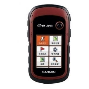
Garmin Etrex309X GPS Handheld with Manual in Chinese and English
Garmin eTrex309X handheld GPS
Garmin eTrex 309x
Field collection and GIS survey expert beidou double star edition
Garmin's new generation of GPS+ beidou dual-star receiver brings you faster and more accurate positioning and navigation experience, adhering to the characteristics of professional, stable and portable eTrex series handheld, strong and waterproof, energy saving and lower consumption.ETrex309x have three axis electronic compass and barometric altimeter, pre-loaded with detailed navigation map 2840 counties, covering the whole country for DEM, the contour and custom maps, using anti-dazzle color screen, under the strong light is still clearly visible, and has five to rocker button operation design, provide your field acquisition humanized one-handed manipulation when working experience.
Binary positioning
It can receive GPS and beidou satellite systems at the same time, which can enhance the reception capacity and speed up the positioning speed in places with many shelters.
Energy saving and low power consumption
Up to 25 hours of continuous operation time.
Storage capacity
In addition to the track record of 2000 points and 10000 points, track record can also be based on memory or memory card space size wireless expansion, let you happy record, do not need to worry about space shortage every day.
Navigation measurement is versatile
Pre-installed navigation electronic map and support custom map straight navigation, built-in three-axis electronic compass and air pressure altimeter, positioning and navigation, real-time azimuth, altitude, pressure information a machine to complete.
ANT+ wireless sharing
Use ANT+ to transmit route, route and track information to other compatible machines
| Hardware and performance | ||
| Measurement | 5.4×10.3×3.3 cm | |
| Display size | 2.2 inch | |
| Screen resolution | 240×320 | |
| Storage | 8G | |
| Support SDcard | microSD™Card | |
| Weight (battery included) | 141.7g | |
| The battery specification | Two size 5 (AA) batteries | |
| Battery life | 25 hours | |
| Waterproof indicators | IPX7 | |
| Satellite system | GPS+Beidou | |
| Be able to float | ||
| High sensitive receiver | ||
| interface | USB | |
| Data records | ||
| Number of destinations | 2000 | |
| Route (strip × point) | 200×250 | |
| Track record (point) | 9999 | |
| Save track (× point) | 200×10000 | |
| MAP | ||
| Pre-installed detailed map | ||
| Support navigation map | ||
| Support contour map | ||
| Support DEM elevation map | ||
| Support homemade picture map | ||
| FUNCTION | ||
| Electronic compass | Three axis | |
| Barometric altimeter | ||
| Track area | ||
| Track area | ||
| Position averaging | ||
| Beijing 54, xi 'an 80, CGCS2000 | ||
| Custom attribute collection | ||
| Wireless data transmission | ||
| Buzzer sound alert | ||
| A camera | ||
| Image browser | ||
| Image navigation | ||
| Position averaging | ||
| Moon and astronomical | ||
| Support for custom interest points | ||
| Compatible tide tables | (BlueChart chart is needed | |
| Software support | Support the Garmin BaseCampSupport the Garmin Survey | |
We can use the different international express company, usually, our first choice is DHL. if you have specified requirement , please inform us before the order.
Our Services
your inquiry will be replied within 24 hours, we welcome your email and call at any time.
our products are original and 100% new. and they will be carefully checked before we ship them out.
we provide one year quality warranty, within one year since you bought the products from us, you will get our technology support.
Company Information
Shanghai Galxy International Trade company, Ltd. combining with
developing, researching and producing. Our company is located in
Pudong Developing Zone, and has two subsidiary companies: Shanghai
Galaxy International Trade Co., Ltd. and Mato Opto-electrical
High-tech Company. Our company has researching center and factory
in Changzhou.
Our main products are as following: total station, electronic
theodolite, automatic level, laser level, rotation laser, GPS,
distance laser sensor and accessories, such as tripod, prism, pole,
staff and USB cable for total station. Our company designs software
for many domestic and oversea factories, for example, Boif, TJOP,
Stanley, and Cst-Berger. We have powerful capacity in technical
research, and the products we designed have advanced technology and
steady performance. The non-prism total station and the absolute
coding measure instrument we developed and produced have very
competitive points in the measure instrument market.
We expect that we could cooperate with more business partners from
all over the world. In addition, we can do OEM service for
companies or dealers that want to find better producers in China.
Our goal is to produce the best surveying instruments in the world.
Our target is to globalize the market, internationalize the quality
and maximize the profit!


Garmin Brand Etrex309X GPS Handheld with Manual in Chinese and English
Inquiry Cart
0