
Add to Cart
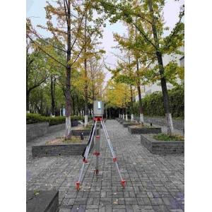
500m maximum range 5mm@40m accuracy HS500i high precision terrestrial laser scanner applied for deformation monitoring
In recent years, 3D laser scanners are increasingly used in the field of landslide deformation monitoring to reduce the risk of landslide disaster. The terrestrial 3D laser scanner can measure the 3D spatial coordinates of landslide surface with high precision, high density, high speed and non-contact, and obtain the set of target surface points. HS500i high-precision 3D laser scanner is a pulsed, full waveform, high-precision and high-frequency 3D laser scanner independently developed by Hi-Cloud.
Through the monitoring technology of HS500i high-precision 3D laser scanner, the deformation monitoring of landslide surface can be studied, and the overall surface deformation of landslide point cloud data set obtained in different periods can be separated by using the methods of point cloud data difference comparison, deformation analysis based on irregular triangulation, regular rectangular grid difference comparison and contour coincidence analysis. The application of 3D laser scanning to monitor landslide deformation provides us with an intuitive and efficient way to monitor the deformation of large-scale landslide with high risk.
Parameters:
Type | HS500i | |
| Ranging Mode | Pulse | |
| Laser Class | Class 1 (eye safe) | |
| Laser Beam Divergence | 0.35mrad | |
| Echo Mode | Full waveform, multi-echo technology | |
| Max. Range | 500m@90%,100kHz | |
| Min.Range | 1.5m | |
| Range Accuracy | 5mm@40m | |
| Laser Pulse Repetition Rate PRR | Max. 500kHz | |
| Scan FoV | vertical | 100°(-40°~+60°) |
| horizontal | 360° | |
| Angular Measurement Resolution | vertical | 0.001° |
| horizontal | 0.001° | |
| Scan Speed | vertical | 3-150scans/s |
| horizontal | max.36°/s | |
| Dual-axis tilt sensor | Range | ±5° |
| Resolution | 0.001° | |
| Data Storage | 240GB(SSD) | |
| Data Transmission | GigE/USB2.0 | |
| Control Mode | Support mobile terminal APP and remote control | |
| Communicate Interface | GigE/USB2.0/WLAN/Camera Trigger/GPS Synchronization,etc. | |
| Operation Temperature | -20℃~+60℃ | |
| Storage Temperature | -40℃~+85℃ | |
| Humidity | non condensing | |
| Protection Class | IP64 | |
| Main Dimensions | φ188mm×318mm | |
| Weight | ca.10.5Kg | |
Features:
1. Range from 1.5m to 500m
2. 5mm@40m range accuracy
3. 100°(-40°~+60°)vertical FoV
4. 0.001° angular resolution
5. IP64 protection level


