
Add to Cart
FoV 75° accuracy 5mm@50m range 1500m PM-1500 2000kHz airborne LiDAR system for coastal zone sedimentation monitoring
Coastal zone is a special area of sea land interaction. Under the background of global sea level rise, coastal zone erosion disaster has seriously threatened the survival and living environment of coastal zone. The coastal zone is rich in tidal energy, wave energy, wind energy and other energy resources. At the same time, there are also sudden natural disasters such as storm surge and typhoon, as well as slow disasters such as coastal erosion, seawater intrusion, land subsidence, sea surface rise, sediment deposition in estuaries and ports. Due to the uncertainty, abruptness and severity of the surrounding environment of the coastal zone, it is very difficult to use traditional means to monitor, especially the large-scale sedimentation monitoring of the coastal zone. Airborne LiDAR system can efficiently obtain a large area of topographic data. Through the comparison and analysis of multi-stage data, it can monitor a wide range of coastal sedimentation.
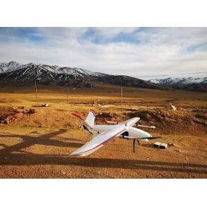
Taking Fenghu VTOL UAV as the carrier, PM-1500 airborne LiDAR system can obtain the laser point cloud data of the coastal zone to be monitored in different periods. Through the pre-procesing of point cloud like denoising and thinning, the multi temporal terrain data of the monitoring area is generated by interpolation. Comparison of the topographic data of different phases can objectively analyze and evaluate the sedimentation of a wide range of coastal zone.
Advantages
1. The overall structure of PM-1500 airborne laser measurement system has been innovatively optimized. It highly integrates sensors such as laser scanner, GPS, IMU and aerial survey camera, etc.
2. The system is lightweight and easy to install. It is suitable for multi platforms such as VTOL fixed wing UAV, multi rotor UAV and helicopter.
3. With the 1500m ultra long range, it is easy to process of high drop terrain data, and can greatly improve the operation efficiency.
4. The ranging accuracy of PM-1500 airborne LiDAR system can reach 5mm@50m, and the comprehensive accuracy of the system is better than 5cm, meeting various high-precision application scenarios.
5. With 2M points/s high frequency, the system has ultra high point density, it is capable for complex operations and suitable for electric
power/forestry/modeling and other scenarios.
6. Applied with 4 times multi-echo technology, the laser can penetrate the surface vegetation gap, and feedback the real terrain distribution.
Parameters
Items | Indicators | Parameters |
| Laser Scanner | Wave Band | Near Infrared (Class 1 ) |
| PRR | 100-2000kHz | |
| Maximum Measurement Range | 1000m@20% | |
| 1500m@60% | ||
| Range Accuracy | 5mm@50m | |
| Angular Resolution | 0.001° | |
| Scan Speed | 40-400 scans/s | |
| FoV | 75° | |
| Camera | Camera Resolution | 42.4MP |
| Focal Length | 28mm | |
| POS System | Position Accuracy(post-processing) | Horizontal 0.01m |
| Elevation 0.02m | ||
| Orientation Accuracy(post-processing) | Heading 0.009° | |
| Pitch/Roll 0.005° | ||
| System Performance | Dimension | 293×165×164mm |
| Absolute Accuracy | horizontal <5cm | |
| vertical <5cm | ||
| Weight | 4.4kg | |
| Multi Echo | 4 times | |
| Temperature and Humidity | Operation: -40℃~60℃, Humidity 85% | |
| Storage: -45℃~70℃, Humidity 85% |


