
Add to Cart
2.5kg 330m@80% range 15mm @150m range accuracy ARS-200 High Precision Airborne LiDAR Survey with 5 times echoes
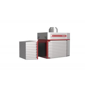
ARS-200 high precision airborne LiDAR survey system is a Riegl LiDAR based mobile LiDAR system. It is developed and built by Wuhan Hi-Cloud Technology Co.,Ltd. The ARS-200 system integrates different sensors such as high-precision laser, high-definition camera, GPS, MEMS inertial navigation and storage control unit. Supported by time synchronization technology of independent intellectual property and integrated multi-sensor integration technology, the system synchronously obtains 3D laser point cloud, POS data and image data. The system has the advantages of light weight, convenient transportation and high efficiency of results processing. It is widely used in application fields as emergency mapping, topographic mapping, power line inspection, highway survey, coastal reef survey, excavation and filling calculation, archaeological survey and mapping and others.
Specifications
ARS-200 Light Laser Airborne Measurement System
| Items | Parameters | |
| System Performance | Absolute Accuracy | horizontal <5cm |
| vertical <5cm | ||
| Weight | 2.5 kg | |
| Laser Scanner | Max. Measurement Range | 330m @80% |
| 290m @60% | ||
| Min. Measurement Range | 3m | |
| Range Accuracy | 15mm@150m | |
| Repetition Accuracy | 10mm@150m | |
| Max. Effective Point Frequency | 100,000 points/s | |
FoV(selectable) | 0~360° | |
| Angular Resolution | 0.001° | |
| POS | Position Accuracy (post-processing) | horizontal 0.01m |
| elevation 0.02m | ||
| Orientation Accuracy (post-processing) | heading 0.012° | |
| pitch/roll 0.005° | ||
| Camera System | Camera Resolution | ≥24M pixels |
| Camera Weight | <500g | |
System Advantages
Application Scenarios
Application of Highway Survey project
1. Project Overview
The main line of the project is about 8km long. The survey area is mainly mountainous terrain, with an average altitude of 600m. The river crosses the survey area, and the altitude drop in some areas is large. The vegetation in the survey area is lush, mostly evergreen broad-leaved forest and low shrubs.
2. Project Requirement
The main task of the project is airborne LiDAR survey and point cloud processing of the certain section of the highway. The mean square error of point cloud elevation is required to be less than 15 cm.
3. Project Difficulties
The traditional surveying and mapping operation is more dangerous because of the traffic on the highway. It is difficult for GNSS receiver to receive satellite signals due to dense vegetation and large altitude drop in the survey area.
4. Solution & Result
ARS-200 high precision airborne LiDAR survey system is applied in this project.
After trajectory calculation, point cloud combine and other data processing processes, the point cloud result is as follow:


