
Add to Cart
GNSS GPS High Accuracy Land Area Distance Surveying GPS Land Survey Equipment
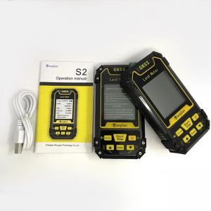
GPS Machine Interface Display:
Machine Technology Parameter:
| Receiver chip | High sensitivity GPS receiver chip |
| Receiver antenna | Passive large-size planar antenna |
| Efficient startup | 1sec for warm boot, 30sec for cold boot. |
| Area accuracy | Measurement error within 0.03Mu(1-3Mu),2%(above 3Mu) |
| Distance accuracy | Within 1m(HDOP less than 1.0,measuring 100m in length) |
| Function characteristics | Longitude and latitude display,altitude display,area measurement,distance measurement,land price calculation |
| Data statistics | Area statistics,distance statistics |
| Area record | 99pieces |
| Distance record | 99pieces |
| Track display | The track will be displayed in real time in the course of measurement,it can also be viewed in statistical records. |
| Barometric leveling | About 1meter(Barometric measurement,the absolute altitude value needs to be calibrated) About 10meters(GPS measurement ,HDOP within1.0) |
| HDOP setting | Custom HDOP setting |
| Screen display | 2.4 inch outdoor HD black-white |
| Prompt tone | Voice broadcast |
| Working temperature | -20°C~65°C |
| Storage temperature | -40°C~75°C |
| Equipment size | 117mm×61mm×22mm |
| Equipment weight | 120g(No battery) |
| Data interface | USB interface,it can be charged through this interface |
| Standard configuration | Host 1,lithium battery 1,charger 1,data line 1,lanyard 1,instruction 1,warranty card 1,packaging box 1. |
Setting:
1. unit setting:
Press the up and down button to adjust the requirement value, set number and unit, press [enter] button to the next.power button to save data.
2. Parameter setting:
Press the up and down button to adjust the requirement value,press [enter] button to the next.power button to save the data.
3. System setting:
Press the up and down button to adjust the requirement value, set number and unit, choose the height from GPS and Barometer. Press [enter]
button to the next.
4. ASL Calibration:
Press the up and down button to adjust the requirement value, and press [enter] button to save the data, press the power button to back.
5. Data record:
(1) Data statistics
Press [enter] button to delete and power button to return
(2) Measuring record
Press the [Setting] button to view graphic,[enter] button to delete and the up and down button to move, press power button to return.
6. Time zone choose:
Choose the time zone of your area and press the [Enter] button to select.
7. Factory reset:
Restore the factory setting, Yes or No? The [Enter] button is Yes and power button is No.