
Add to Cart
GNSS Handheld Locator GPS Land Meter Device Location Finder GPS Site Survey Equipment
Multi-functional and multi-requirement design Wanggan S8 locator can do altitude survey, position navigation , travel records, accurate positioning and project lofting.
This Wanggan S8 locator device could be used in lots of situations and applicable to a variety of fields, such as electric power circuit, field survey, communication base station, moon and astronomical, land survey, outdoor hiking, outdoor cycling, field exploration and sea fishing
The Function of Lofting
Four Patterns
. (Select Points) Select existing navigation points as lofting points.
. (Equal Division) Setting the number of lofting points,generate equal distance lofting points automatically.
. (Equal Distance) Setting the distance,generate lofting points automatically.
. (User-defined Distance) Setting the distance of the single segment,generate lofting points.
Two Steps
. Select lofting mode
. Accurate lofting following with navigation
The function of Navigation Point
. Get varied and accurate location information
. The function of taking the navigation point automatically
. The function of inputting the collection navigation point manually
The function of navigation route and track
. Customize edit navigation route(Edit navigation points into route)
. Real-time track recording(Travel records)
S8 tractor makes navigation more direct and convenient, Wanggan S8 tractor has real-time navigation, deviating remainder, speed display, waypoint navigation, route navigation and track navigation.
| Receiver Antenna | Taimeng Passive Large - Size flat plate antenna | ||
| Positional Time | Hot Start Time: one Second; Cold Start Time: 30 Seconds | ||
| Positional Accuracy | Within 2 Meters (HDOP Value Less Than 1.0) | ||
| Area Accuracy | Measurement error is not more than 0.03 Mu (1-3 Mu), 2% (More Than 3 Mu) | ||
| Distance Accuracy | Within one Meter (When HDOP value is less than 1.0 measure the length of 100 meters) | ||
| Functional Characteristics | Coordinate Measurement, Route Edit, Track Record, Navigation Function,Altitude Measurement,Area Measurement, Distance Measurement,Lofting Function | ||
| Data Statistics | Area Statistics, Distance Statistics | ||
| Area Record | 99 pieces | Waypoint Record | 2000pieces |
| Distance Record | 99 pieces | Track Record | 100pieces |
| Route Record | Maximum Number Of Editions 200, Single Route Up To 400 Points | ||
| Track Display | The trajectory will be displayed in real time during the measurement process,and the past measurement figures can also be viewed in the statistical records. | ||
| Barometric Altimetry | About one meter (Barometer measurement, absolute altitude needs to be calibrated) About 10 Meters (GPS Measurement, HDOP value below 1.0) | ||
| HDOP Settings | User-Defined HDOP Setting | ||
| Display Screen | 2.4 Inch, outdoor high- definition black-and-white screen | ||
| Working Temperature | -20"C ~65"C | ||
| Storage Temperature | -40"C~75"C | ||
| Device Size | 117mm*61mm*20mm | ||
| Device Weight | 120 g (Battery Free) | ||
| Data Interface | USB Interface, Which Can Be Charged Through This Interface | ||
| Data Export | √ | ||
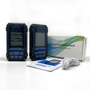
| Standard Configuration | Host*1,Lithium Battery* 1, Charger*1,Data Cable*1, Lanyard*1, Manual*1,Warranty Card*1, Package*1 | ||