... photogrammetry, which is more effective for the of small-scale . Facing the operation demand of large-scale ...
Add to Cart

Windows CE Modern Design Total Station The ZTS-360/R is configured with advanced dual-axis compensatorfor auto error elimination...
Add to Cart
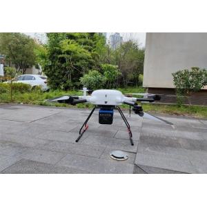
gAirHawk GS-260S UAV LIDAR SCANNING SYSTEM Drone LiDAR Scanning System mounted on DJI M300 Application for gAirHawk GS-260S is a k...
Add to Cart

24LB 28LB Coated Bond CAD Plotter Paper Roll For Printing Colored ► Coated CAD Plotter Paper Description Weight 20lb, 24lb, 28lb, 32lb...
Add to Cart
...
Add to Cart
...
Add to Cart
Product Introduction Hi-target GPT3502Ln Total Station Class1 Safe Pulse Laser EDM Laser Pointer for Reflectorless Measurement and Layout Point Guide ...
Add to Cart
UAV LiDAR Scanning System Geosun GS-100C+ Livox Avia Topographic Surveying And Mapping Solution 5-Power supply Power supply for galvo head and control...
Add to Cart
SW-6000 China Ophthalmic equipment Corneal Topography Corneal Topography SW-6000: By PLACIDO cone, 31 rings, a total of 7936 points. Through calculati...
Add to Cart
... web based GPS tracking systemvehicle car tracking for GPS Tracking Model TB05 ( Enterprise edition GPS monitoring and management syst...
Add to Cart
...; 2.can use the video player, play any video; 3.can use the music player, play any songs; 4.You can log in to Google PLAY online and download any s...
Add to Cart
..., Platform, System For Fleet Easy Management Jointech Cloud GPS tracking for fleet management. Jointech clould tracking a...
Add to Cart
Detailed Product Description The iHand30 Handheld Controller is a rugged field controller that is designed for data collection and GNSS device control...
Add to Cart
... controller. Through the use of Driver which true "contents" pose for reading the files contained in the control units, you can easily find the dat...
Add to Cart
Android Box Navigtion for JVC Unit , Free Map Upgrade and Software Upgrade , Android 4.2.2 AVH-X1750DVD, AVH-X2750BT, AVH-XL4750DVD, AVH-XL4750DVD, AV...
Add to Cart
UHF 1.3G/1.4GHz Mapping Drones/VTOL Video links With Easy Configuration Via Software FIM-1440 is a revolutionary UHF 1.3G/1.4GHz Full HD digital video...
Add to Cart
.../RJ45 cable /Event for SM 1310/1550nm Functions 1. Support charging treasure charging, do not worry about the battery is not enough 2. In line ...
Add to Cart
Jimmy Yin Chongqing Gold Mechnical & Electrical Equipment Co.,Ltd Email: gold02@hy-industry.com Mobile: +86-15998954947 HD-MAX is a full-digit echo so...
Add to Cart
... Inspection Description mdLiDAR1000UHR means ultra-high resolution via a 32-channel LiDAR sensor, fully integrated with an improved 72.5° fi...
Add to Cart